
Dams of the Rumoi Area
The dams of Rumoi sub-prefecture aren’t large-scale dams like the Hoheikyo Dam or the Taisetsu Dam, however each dam is unique in purpose and appearance. It’s odd how well a manmade concrete structure can become a part of its natural surroundings. Lets take a trip to visit the tangible evidence of how man exists with nature.
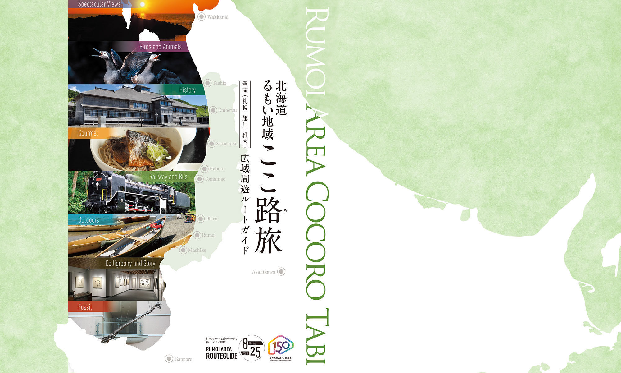
①Tamiyasu Dam(Teshio)
It is distance of 5km from only 4km, the Teshio city area from the shore. The tree planting of the cherry tree is carried out by the hand of the townsman.
This dam is only 4 km from the ocean and 5 km away from Teshio town limits. The townspeople have planted many cherry trees in the dam vicinity.
*Scenic spot for cherry blossoms
Address / Minamisarakishi, Teshio
Type / Earth
River / Sarakishi No.14 River
Reservoir / –
Year of Completion / 2001
Intended Use / Irrigation
Dam Height / 24.0m
Crest Length / 260.5m
Management / Teshio Town
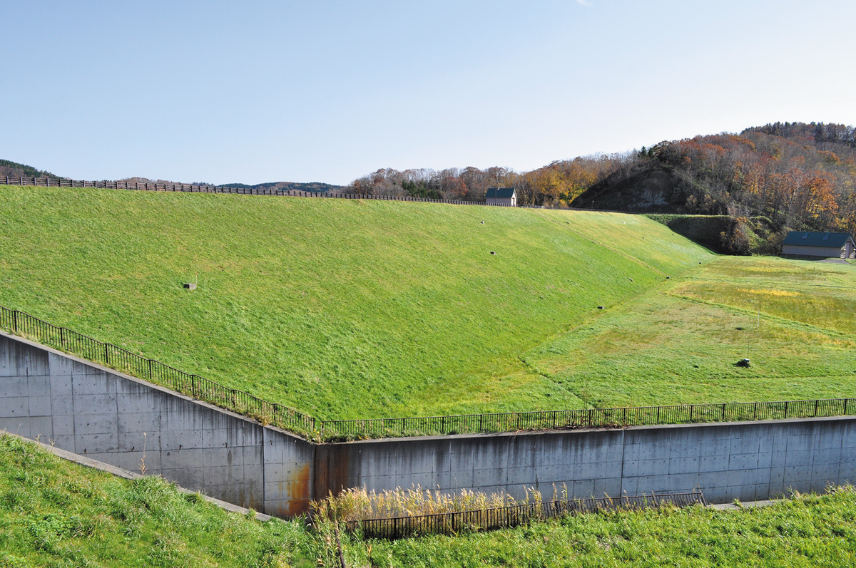
③Ariake Dam(Shosambetsu)
This is the northernmost concrete dam of Rumoi sub-prefecture. This design of this dam is simple with 1 crest gate in the center.
*Scenic spot for autumn leaves
Address / Ariake, Shosanbetsu
Type / Concrete gravity
River / Mochikubetsu River
Reservoir / Higashiyama Lake
Year of Completion / 1971
Intended Use / Flood control, Farmland disaster prevention, Unspecified use, River maintenance
Dam Height / 21.7m
Crest Length / 250.0m
Management / Hokkaido Prefecture
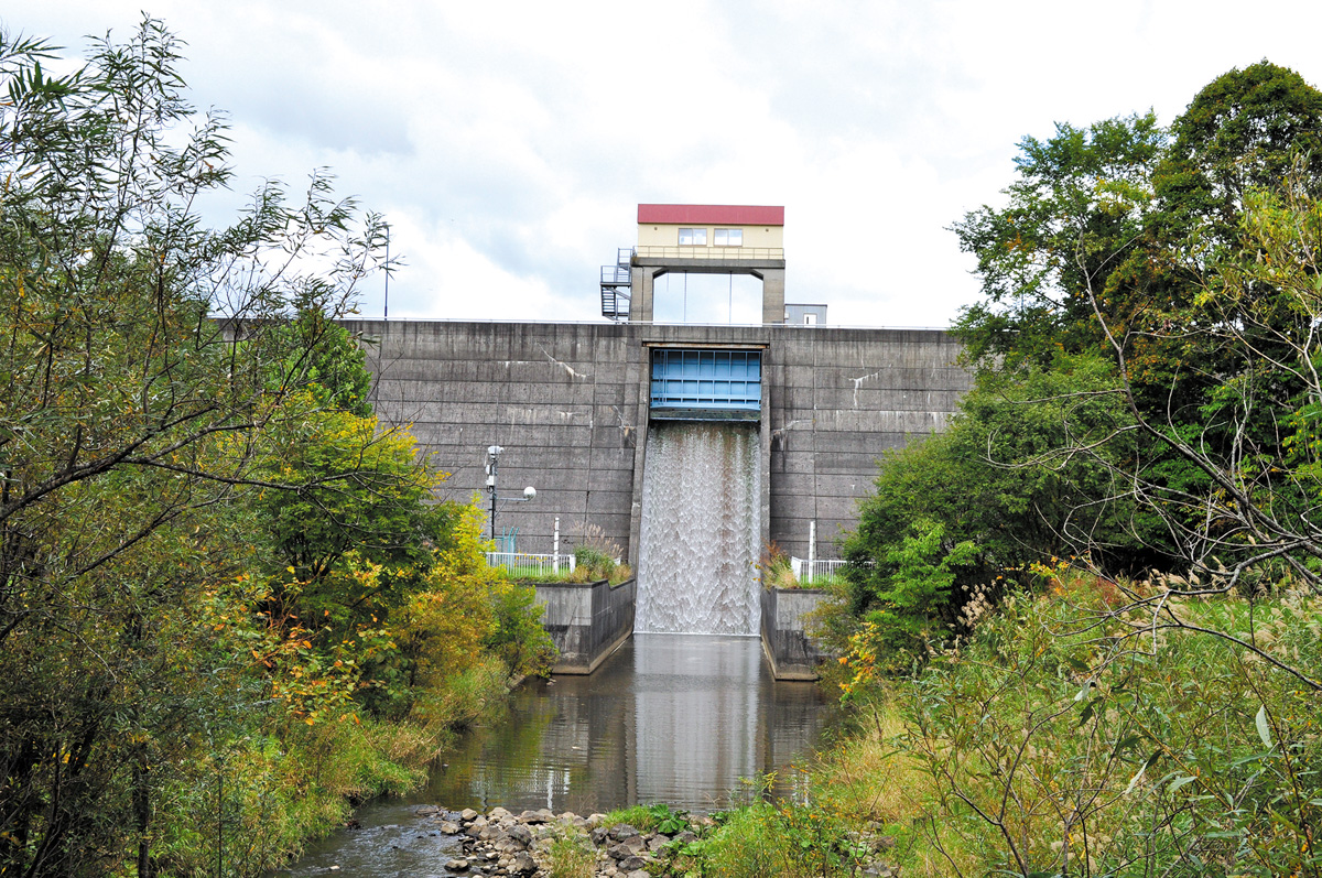
⑧Tomamae Dam(Tomamae)
This dam is located near the restored side of the Sankebetsu bear attack. The overflow type spillway is made of 6 gates which span the crest of this beautiful dam.
Address / Sankei National Forest, Tomamae
Type / Concrete gravity
River / Sankebetsu River
Reservoir / –
Year of Completion / 1999
Intended Use / Irrigation
Dam Height / 34.8m
Crest Length / 155.0m
Management / Tomamae Town
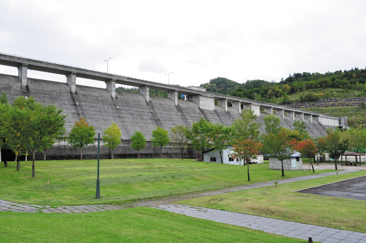
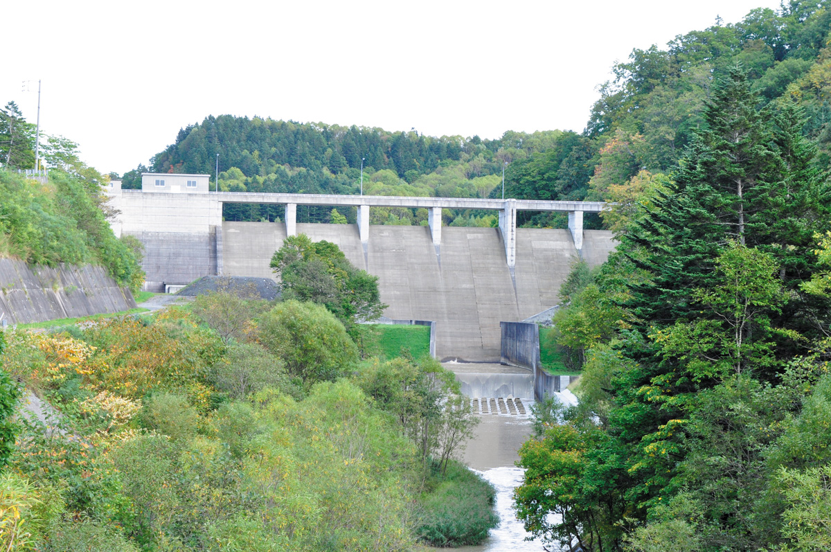
⑨Obira Dam(Obira)
A park stretches out at the base, making this a very accessible dam. The dam itself is noteworthy for its width.
*Scenic spot for autumn leaves
*The free PR cards which the bureau of dam management
Address / Takinoshita, Obira
Type / Concrete gravity
River / Obirashibe River
Reservoir / Lake Obirashibe
Year of Completion / 1992
Intended Use / Flood control, Farmland disaster prevention, Unspecified use, River management, Irrigation, water surpply/sewage
Dam Height / 42.4m
Crest Length / 475.0m
Management / Hokkaido Prefecture
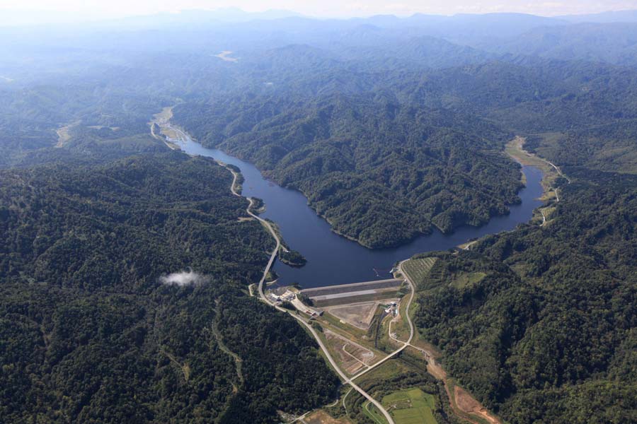
⑫Rumoi Dam(Rumoi)
In 1988, Rumoi city and the surrounding river basin area suffered serious damage due to the heavy rains and consequential overflowing of the Rumoi River. Plans to install flood preventative measures were drawn up and the Rumoi Dam was completed on the tributary Chibaberi River in 2009. Flood control, water works facilities and water level maintenance are the three purposes this dam fulfills. This is the only rock-fill type dam in Rumoi sub-prefecture.
*The free PR cards which the bureau of dam management
Address / Chibaberi, Rumoimura, Rumoi
Type / Rock-fill
River / Chibaberi River
Reservoir / Chibaberi Lake
Year of Completion / 2009
Intended Use / Flood control, Water supply, Water flow Management
Dam Height / 41.2m
Crest Length / 440.0m
Management / Hokkaido Development Bureau
Dam terminology
Rock-fill
This is a type of fill-dam where the dam is built of tightly packed rocks.
Concrete gravity
This type of dam is made of concrete. It is the most common type of dam.
Crest
The crest is the top of the dam. Here the overflow-type gate is referred to as a “crest gate”.
Earth
An earth dam is a type of fill-dam and is made of compacted dirt and soil. A zonal model earth dam is built with an impermeable wall within the dam.
Dam Height
The height is measured from the dam base to top of the main structure.
Crest Length
The length or width of the crest on a dam.